
Вернуться к статье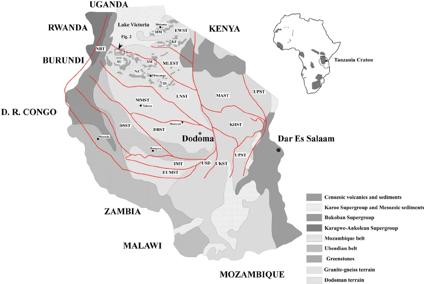
Комплексное дистанционное зондирование и минералогическая характеристика проявлений урана в районе Намайени, река Мкуджу, Танзания
Simplified geological map of Tanzania showing principal tectonic units and terrane boundaries, distribution of Precambrian basement units (Tanzania Craton, Ubendian Belt, Mozambique Belt, Kibaran Belt), Karoo sedimentary basins, and the East African Rift System
known uranium occurrences (Mkuju, Manyoni, Bahi) are marked with symbols. Modified after Kabete et al. (2012) [2] and the Geological Survey of Tanzania